Our news
ConnectField is being deployed in Congo to map the electricity distribution network
Field Service Mobile Application
ConnectField deployed in Congo to map the electricity distribution network
Sifens, one of the leading Congolese service integrators, has chosen Dotic’s solutions — ConnectField and ConnectServices — for the geolocation of residential electricity distribution points, combined with field surveys conducted prior to the installation of a new generation of electricity meters by Energie Electrique du Congo (E²C) in Pointe-Noire.
Today, far beyond being a “simple” field service application designed to audit predefined technical points, ConnectField stands out as one of the most relevant solutions on the market for conducting surveys and ensuring the reliability of all types of field operations, such as asset inventories, project risk monitoring, preliminary studies, staking out, technical intervention tracking (works, maintenance, etc.), and quality audits
Geolocation of Connection Points and Network Digitization
For several months, Sifens has been carrying out an operation to identify and geolocate residential subscribers in the field. The location of electricity distribution points is linked to a digital survey form detailing technical information (site access, types of existing connections, etc.), enabling the organization and optimization of the deployment of new meters.
Project objectives:
-
Geolocate delivery points
-
Collect all administrative and technical information required for the deployment of new meters
-
Obtain a precise and qualified mapping of the subscriber network, including detailed information on existing equipment
-
Generate detailed and exportable intervention reports
Sifens previously had no digital mapping of residential distribution points. The project was initiated using a neutral base map of Pointe-Noire, integrated into the ConnectServices web-based mapping platform. A specific layer dedicated to these entities was then created using field survey data.
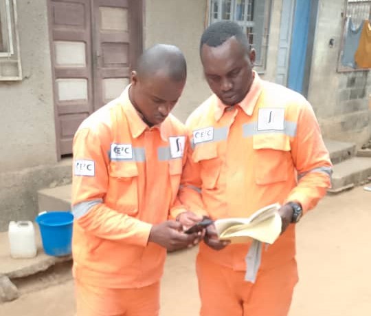
The deployment of the new “entity creation” feature within the ConnectField mobile field service application enabled Sifens teams to conduct their surveys by visiting subscribers directly, based on an address list. They could manually create and georeference each “point” within the application and collect the required information using a form specifically developed for the mission.
This operation, carried out so far for 20,000 residential subscribers, now provides Sifens and its client with a digital twin of the residential subscriber network.
Autonomous Management Thanks to Our Comprehensive Mapping Solution
Dotic develops reliable geolocation-based solutions designed to empower users in managing their projects independently. After a training and onboarding period — particularly on ConnectServices, in collaboration with our GIS teams — Sifens quickly became autonomous in managing its projects according to its own processes and needs. The ergonomics and ease of use of the ConnectField mobile data collection application enabled immediate adoption by field operators.
In practice, the process is as follows:
-
The general base map of the survey area is integrated by Sifens into the ConnectServices web platform.
-
Administrators define work areas as “projects” according to their needs and assign ConnectField users, who receive all relevant information directly on their smartphones.
-
Surveyors visit the sites based on their printed address list. Once on site, they simply “create” the entity with a single click in the application. The position is geolocated and saved. The dedicated survey form opens automatically, and the operator follows the workflow to collect the required information.
-
Once the survey is completed, the field operator synchronizes the data from their phone. The data (geolocation, technical information, photos, etc.) are directly integrated into and accessible via ConnectServices. Each connection point can be viewed on the web-based mapping platform. The collected data can be exported in Excel format, enabling Sifens to transparently share project progress with its client.
According to Paul Tchimpamba, Smart Meter Deployment Project Manager at Sifens:
“Beyond the technical performance — notably the ‘entity creation’ feature and our associated survey form — of the ConnectField mobile field service application and the ConnectServices platform, the support and involvement of Dotic’s teams in developing solutions tailored to our specific needs enabled us to carry out our audits under the best possible conditions. We now work with full autonomy in planning and monitoring our interventions at subscribers’ premises. Our surveyors quickly adopted the application, and we are currently building a precise and qualified mapping system that is invaluable for our client’s operations.”