Use cases
Utility network data quality control after infrastructure deployment works
At the end of construction and deployment works, this data must be integrated into the geographic information system (GIS). However, collected information often contains anomalies such as inconsistencies, structuring errors, missing data or non-compliant records.
Geospatial data at the core of utility network operations
The geospatial data associated with infrastructure assets and utility networks is used daily to:
- locate every infrastructure component
- classify and qualify network assets
- validate network continuity and routing (optical routes, water pipelines, electrical distribution paths, etc.)
- plan field interventions
- monitor network condition and performance
- analyse operational efficiency
- support operational decision-making
The quality of this data, validated at the end of construction works through ConnectControl, directly impacts the efficiency of future network operations — whether within the client’s information system or through the ConnectServices web GIS platform.


Detect network anomalies directly within geospatial data
Data quality control helps detect several types of anomalies within utility network and geospatial datasets:
- topological inconsistencies
- data structuring errors
- missing or incorrect attributes
- non-compliance with industry data standards
- discrepancies between GIS data and field reality
These anomalies must be identified and qualified before any integration into the information system or GIS environment.
Verify data compliance before GIS integration
Before integrating data into the GIS environment, it is essential to:
- verify data completeness
- control data consistency and integrity
- ensure compliance with industry standards and business rules
- guarantee compatibility with the existing GIS repository
This validation process helps prevent the integration of incorrect or unreliable geospatial data.
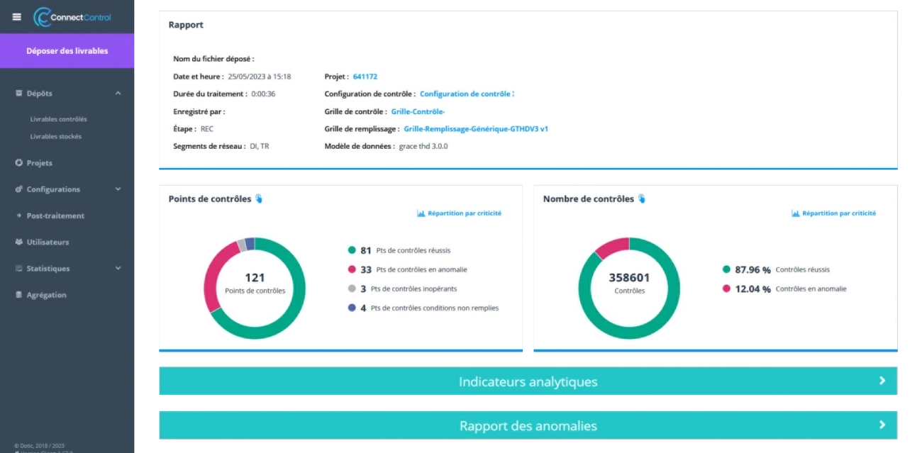
Automate geospatial data quality control
Manual geospatial data validation is often time-consuming, complex and difficult — if not impossible — to maintain consistently over time.
With Dotic’s solutions:
- data is analysed at scale through ConnectControl using predefined business rules and industry standards
- anomalies are automatically detected and classified without manual intervention
- validation reports are generated to simplify analysis and quality review
- results can be directly exploited by project and operational teams
Data can then be visualised and cross-analysed within ConnectServices, making it easier to locate anomalies and better understand their operational impact.
The result:
- significant time savings
- consistent and standardised validation workflows
- continuous improvement of geospatial data quality
Ensure continuity between field operations and the GIS data repository
Data quality control should never be disconnected from field operations.
With Dotic’s solutions:
- field data collected through ConnectField is directly integrated into the system
- discrepancies between GIS data and field reality can be identified more easily
- corrective actions can be launched and monitored quickly
This continuity helps ensure consistency between geospatial data and the operational monitoring of infrastructure assets within the GIS environment.
Secure utility network and infrastructure operations
Effective geospatial data quality control helps organisations to:
- validate deliverables provided by construction and deployment contractors
- improve the reliability of GIS and infrastructure data
- reduce operational errors
- simplify network maintenance operations
- improve operational and strategic decision-making
Reliable data is a key foundation for efficient utility network and infrastructure management.
A key step in the infrastructure asset management lifecycle
Management of outstanding issues and corrective actions
- Identify anomalies, monitor corrective actions and ensure their resolution.
Planning and monitoring field operations
- Organise field operations and prioritise corrective and operational actions.
Validation of project completion and handover
- Verify that completed infrastructure assets comply with operator requirements and improve the reliability of geospatial data before operational use.